


USA Elevation Map
USA Elevation Map
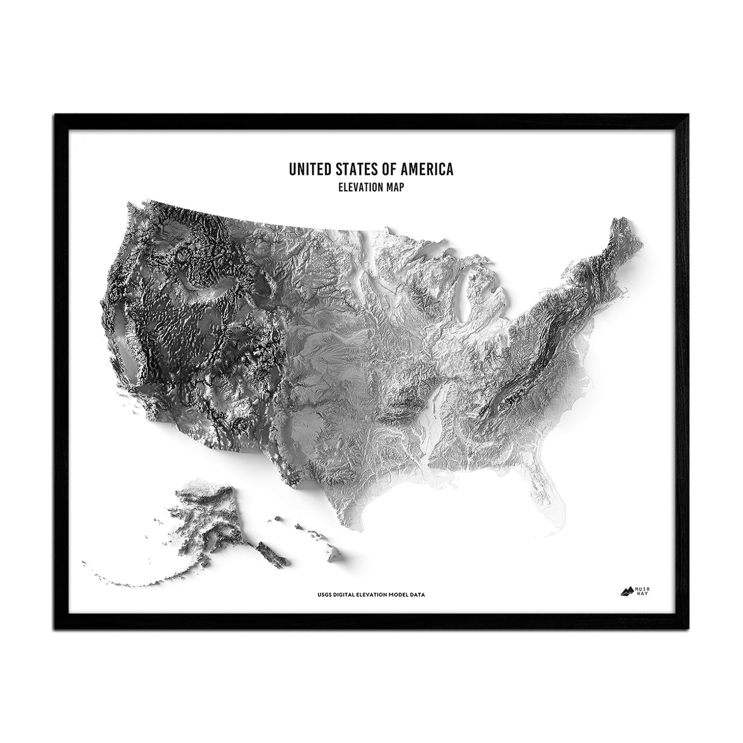
This museum-quality elevation map offers a beautiful perspective of the United States.
Regular price
$79
Regular price
Sale price
$79
Unit price
per
Couldn't load pickup availability
-
 Easy 15 Day Returns
-
 Fast & Secure Shipping
-
 Authorized Retailer
Editor’s Note
The landscape of the United States was once a mystery. Curiosity led men to discover its diverse terrain over many years. This relief map offers a birds-eye view of the USA, which uses ALOS Digital Surface Model data that is magnified before exaggerating elevations to create a compelling map. All 50 states are represented on the map, which is produced on a 12-color gicleé printer using premium inks for intricately detailed, fade-free visuals. The maps are printed on archival paper in the USA and certified to last 100 years.
Details & Specs
- Archival Paper and Inks
- 100% Cotton, OBA-Free, and Acid-Free
- Heavyweight 21.5 mil
- Certified to last 100 years