


Hydrological Map of North America
Hydrological Map of North America
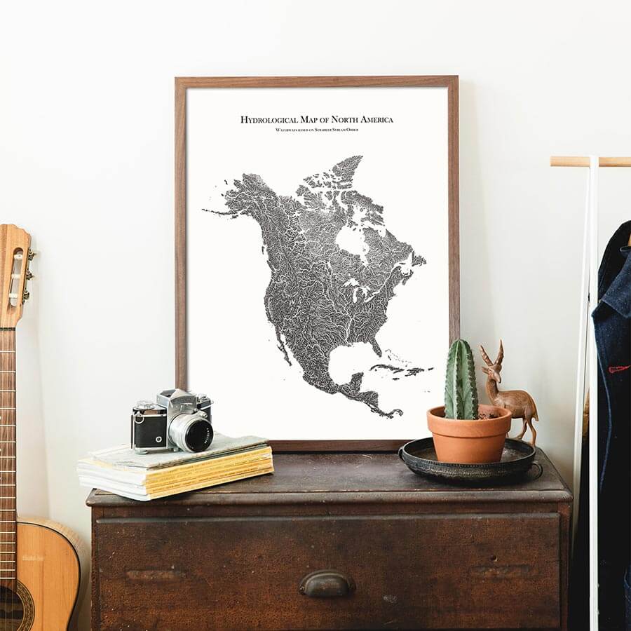
North America’s waterways and lakes headline on this museum-quality map, printed in the USA.
Regular price
$79
Regular price
Sale price
$79
Unit price
per
Couldn't load pickup availability
-
 Fast & Secure Shipping
-
 Authorized Retailer
Editor’s Note
It was once unchartered wild terrain. Now, we can zoom in on the details of each river, stream, and the tributaries that feed them. North America's waterways and lakes are the focus of this hydrological map, with each determined by its Strahler number, which defines its size based on the hierarchy of tributaries. The maps are produced on a 12-color gicleé printer using premium inks for intricately detailed, fade-free visuals. The museum-quality maps are printed in the USA and certified to last 100 years.
Details & Specs
- Archival Paper and Inks
- 100% Cotton, OBA-Free, and Acid-Free
- Heavyweight 21.5 mil
- Certified to last 100 years