


Colorado Elevation Map
Colorado Elevation Map
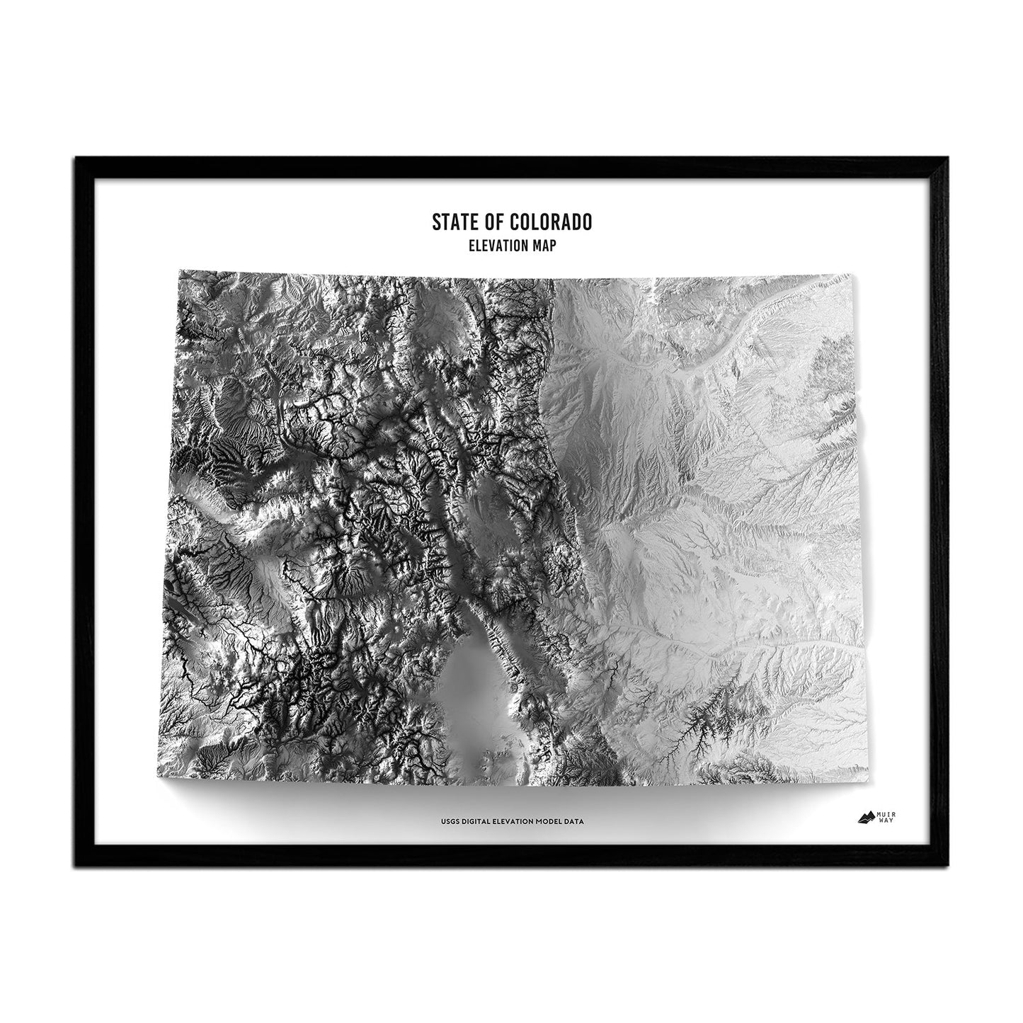
The compelling landscape of Colorado is the focus of this beautiful elevation map.
Regular price
$79
Regular price
Sale price
$79
Unit price
per
Couldn't load pickup availability
-
 Easy 15 Day Returns
-
 Fast & Secure Shipping
-
 Authorized Retailer
Editor’s Note
Known for its mountains, forests, mesas, canyons, and more, Colorado’s landscape is one of the most diverse in the USA. All of that and more are in focus in this elevation map, which magnifies DEM data and exaggerates elevations to create a compelling visual experience. The museum-quality map is produced on a 12-color gicleé printer using premium inks for intricately detailed, fade-free visuals. They are also printed on archival paper in the USA and certified to last 100 years.
Details & Specs
- Archival Paper and Inks
- 100% Cotton, OBA-Free, and Acid-Free
- Heavyweight 21.5 mil
- Certified to last 100 years