


Adirondack Trails 1974 Shaded Relief Map
Adirondack Trails 1974 Shaded Relief Map
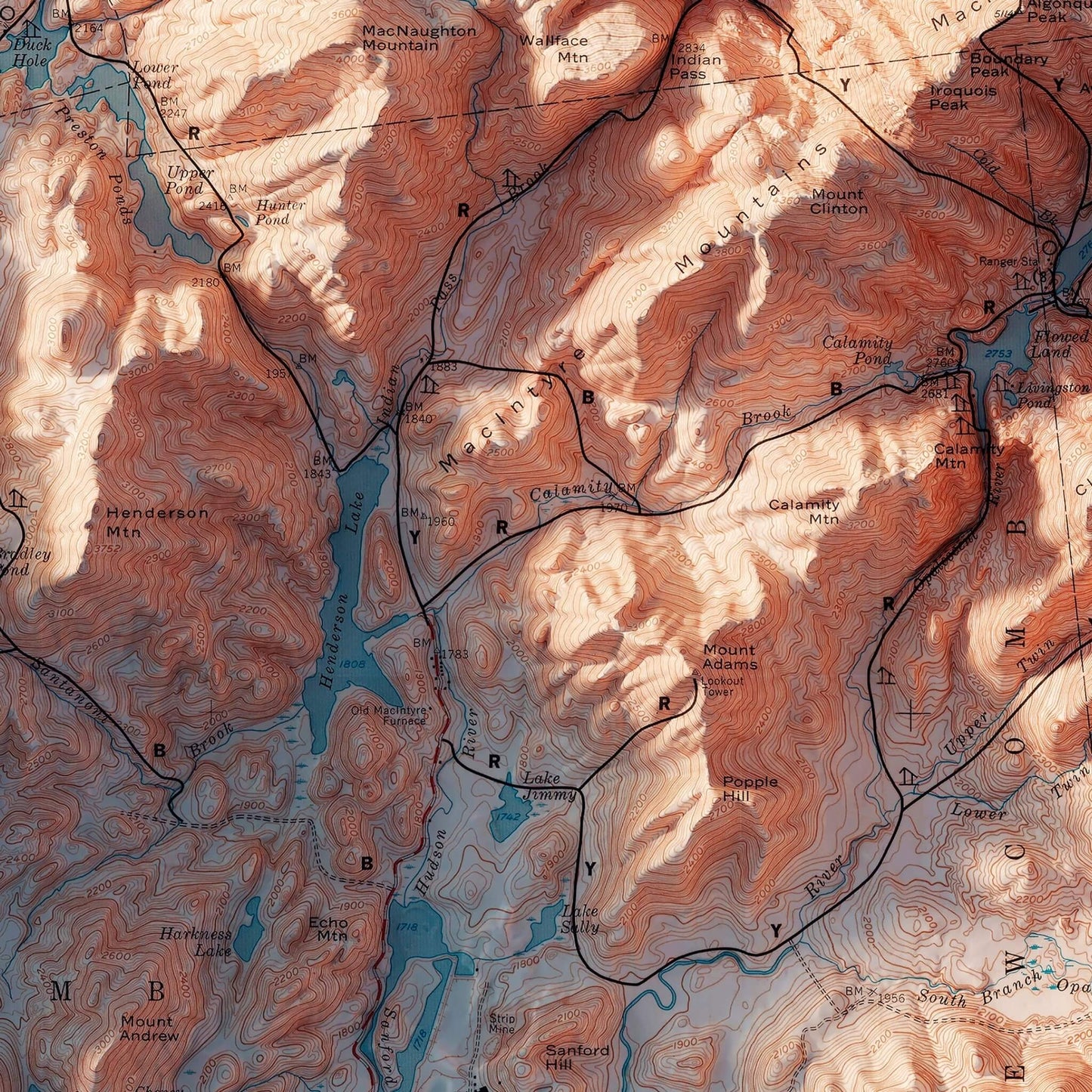
This 1974 map is elevated using Digital Elevation Data and shaded relief.
Regular price
$99
Regular price
Sale price
$99
Unit price
per
Couldn't load pickup availability
-
 Easy 15 Day Returns
-
 Fast & Secure Shipping
-
 Authorized Retailer
Editor’s Note
Popular hiking destinations since the 1920s, the Adirondack Trails in New York feature 46 mountain peaks. This map from the High Peak Region was created in 1974 by the Adirondack Mountain Club. Thanks to Digital Elevation Data and meticulously adding shaded relief to the landscape, it takes on a beautiful 3D look and feel. Each map is produced on a 12-color gicleé printer using premium inks for intricately detailed, fade-free visuals. The maps are printed on archival paper in the USA and certified to last 100 years.
Details & Specs
- Archival Paper and Inks
- 100% Cotton, OBA-Free, and Acid-Free
- Heavyweight 21.5 mil
- Certified to last 100 years