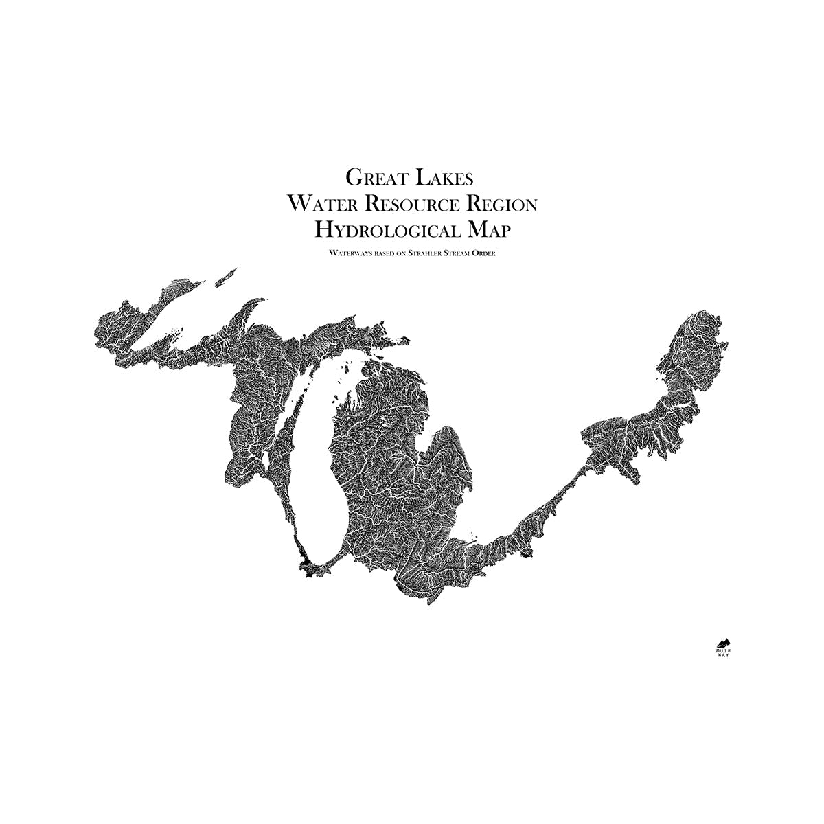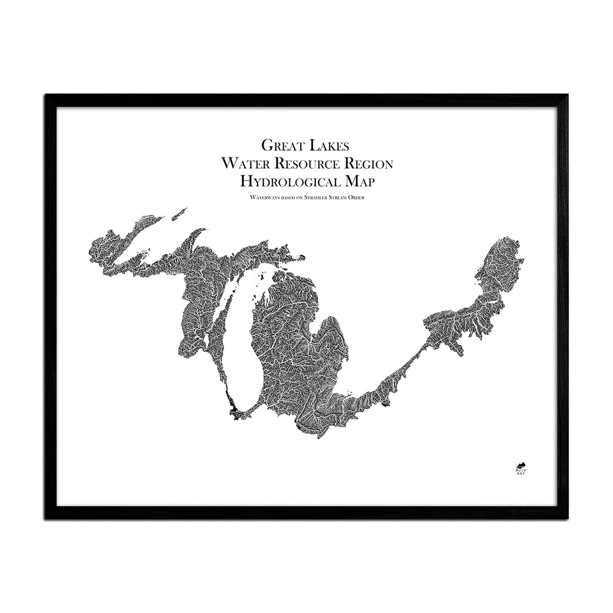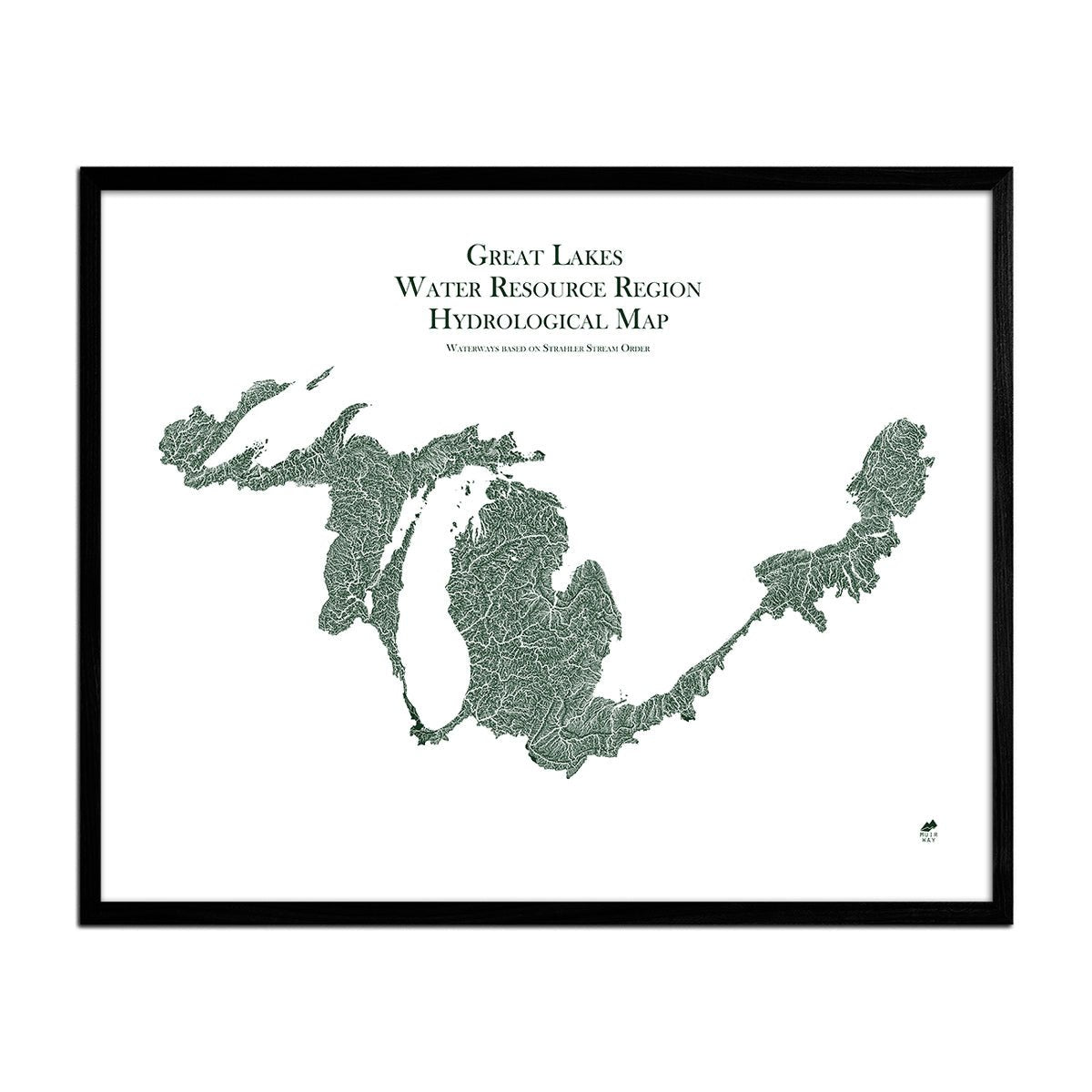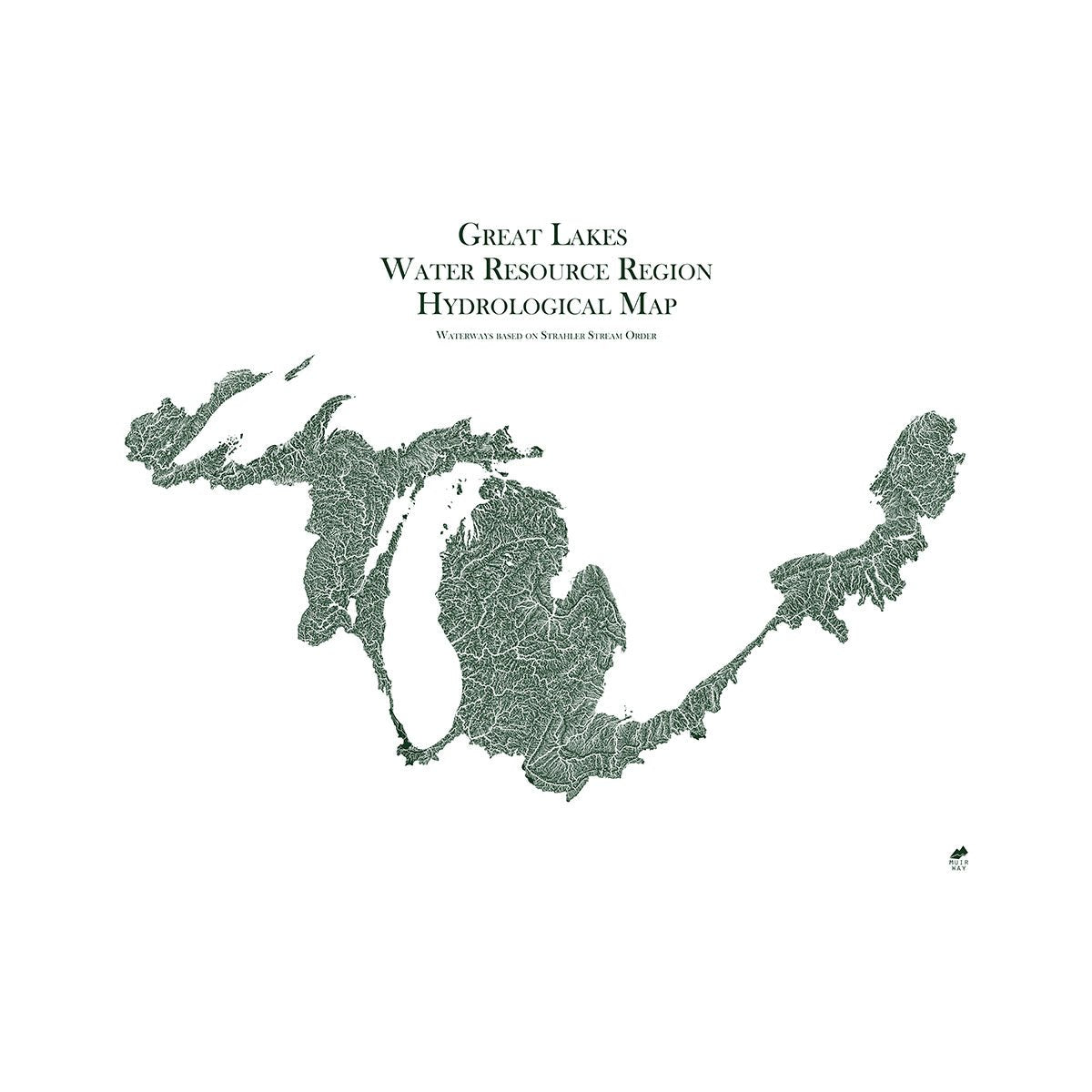


Great Lake Regional Hydrological Map
Great Lake Regional Hydrological Map
Every river and body of water in the Great Lakes region is represented on this museum-quality hydrological map.
Normaler Preis
€70,95
Normaler Preis
Verkaufspreis
€70,95
Grundpreis
pro
Verfügbarkeit für Abholungen konnte nicht geladen werden
-
 Easy 15 Day Returns
-
 Fast & Secure Shipping
-
 Authorized Retailer
Editor’s Note
The lifeblood of America is water. This map provides all the details on how it flows through the Great Lakes region. Included are every river, even intermittent streams, and every body of water with a diameter greater than .2 miles. Displayed in fascinating detail and offered in multiple colors, each map is produced on a 12-color gicleé printer using premium inks for intricately detailed, fade-free visuals. The maps are printed on archival paper in the USA and certified to last 100 years.
Details & Specs
- Archival Paper and Inks
- 100% Cotton, OBA-Free, and Acid-Free
- Heavyweight 21.5 mil
- Certified to last 100 years