


Wyoming Elevation Map
Wyoming Elevation Map
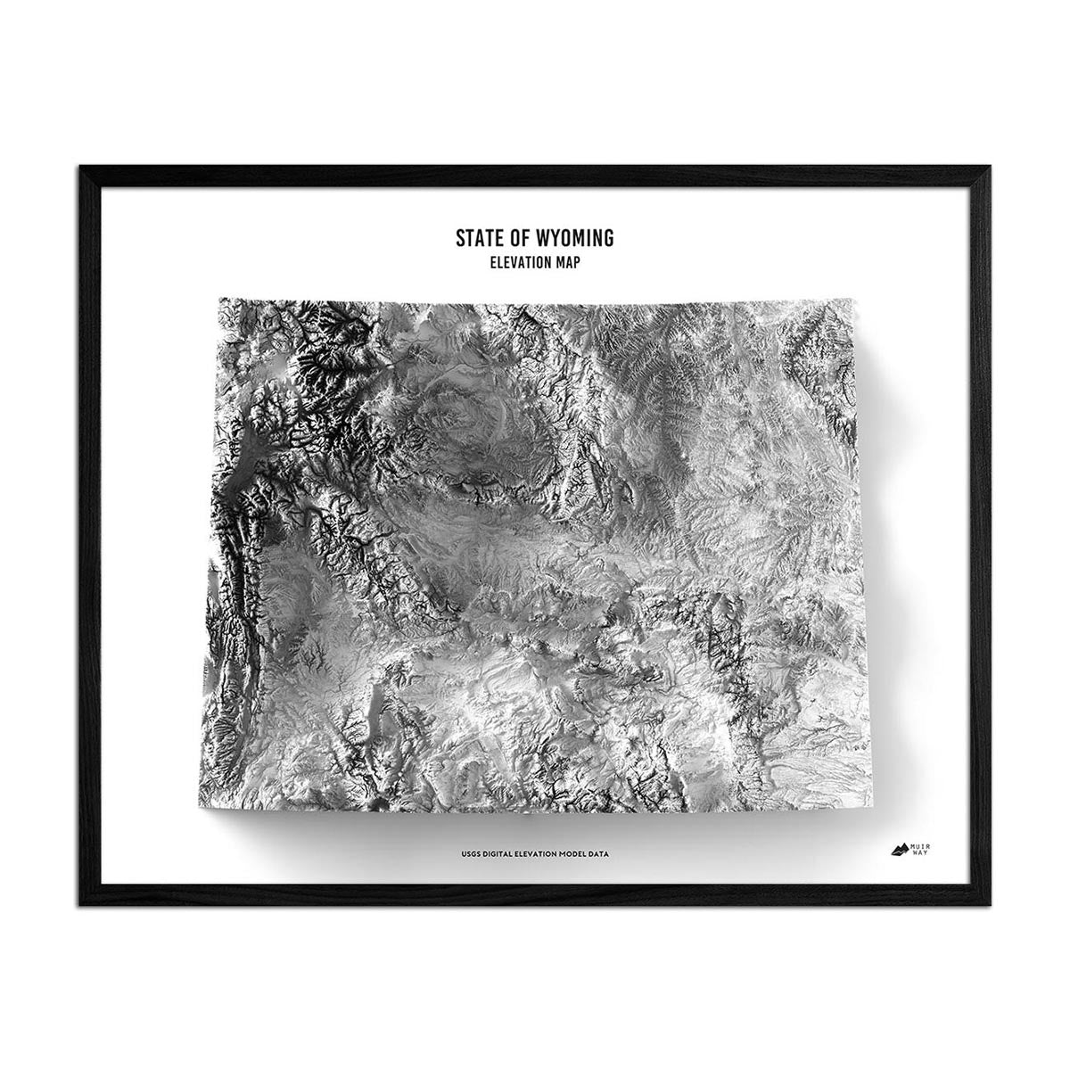
Wyoming’s unique terrain is the subject of this museum-quality elevation map.
Regular price
€70,95
Regular price
Sale price
€70,95
Unit price
per
Couldn't load pickup availability
-
 Easy 15 Day Returns
-
 Fast & Secure Shipping
-
 Authorized Retailer
Editor’s Note
The union’s 44th state, Wyoming is the least populous despite being the 10th largest by area. It features ranges of the Rocky Mountains in the west and high-elevation prairie in the east. This relief map brings it to life in a new way by magnifying the features of its terrain. Each map is produced on a 12-color gicleé printer using premium inks for intricately detailed, fade-free visuals. The maps are printed on archival paper in the USA and certified to last 100 years.
Details & Specs
- Archival Paper and Inks
- 100% Cotton, OBA-Free, and Acid-Free
- Heavyweight 21.5 mil
- Certified to last 100 years