


Caribbean Regional Hydrological Map
Caribbean Regional Hydrological Map
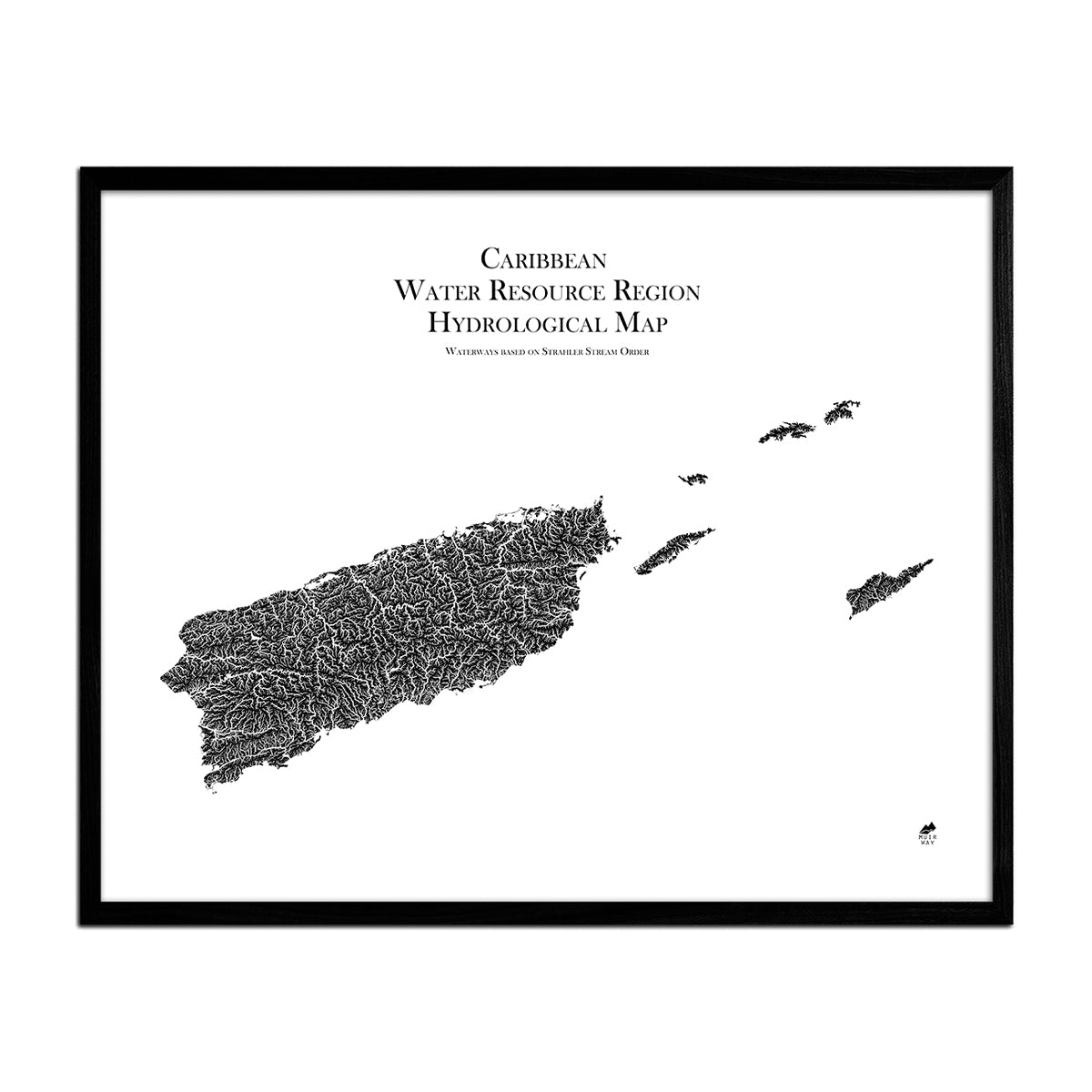
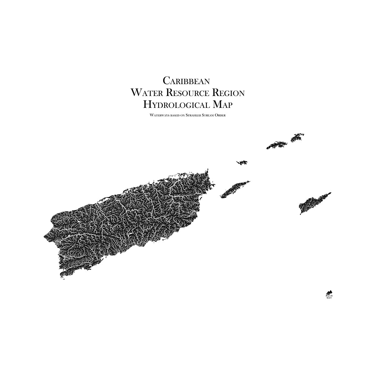
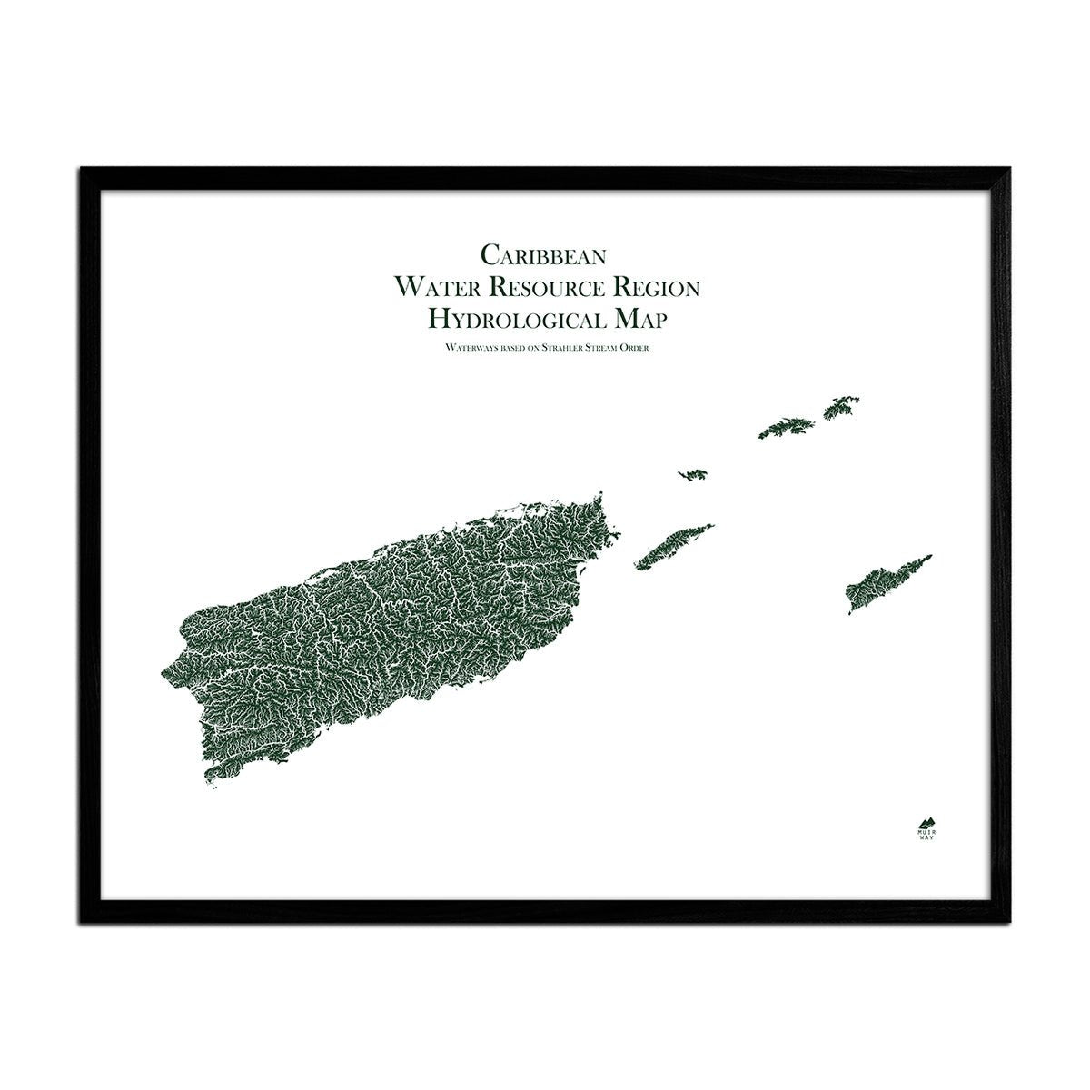
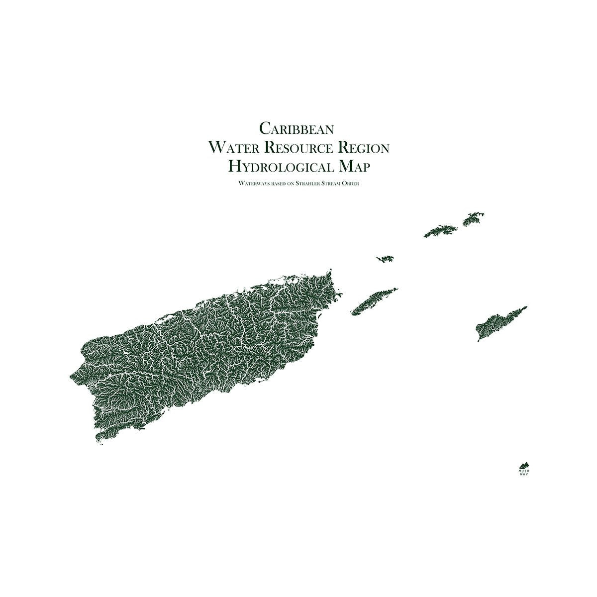
This hydrological map shows how all the rivers and streams in the Caribbean interconnect.
Normaler Preis
€70,95
Normaler Preis
Verkaufspreis
€70,95
Grundpreis
pro
Verfügbarkeit für Abholungen konnte nicht geladen werden
-
 Easy 15 Day Returns
-
 Fast & Secure Shipping
-
 Authorized Retailer
Editor’s Note
Water is an essential part of everyday life worldwide. This museum-quality map shows how it flows through the Caribbean. It includes all the rivers and streams of the Caribbean, Puerto Rico, and the US Virgin Islands and how they flow, interconnect, merge, and diverge. Displayed in fascinating detail and in multiple colors, each map is produced on a 12-color gicleé printer using premium inks for intricately detailed, fade-free visuals. The maps are printed on archival paper in the USA and certified to last 100 years.
Details & Specs
- Archival Paper and Inks
- 100% Cotton, OBA-Free, and Acid-Free
- Heavyweight 21.5 mil
- Certified to last 100 years